Apalachicola National Estuarine Research Reserve
Deep in the shady tupelo and cypress swamps of the floodplain, dark, rich water bleeds into the broader flow of a large alluvial river that makes its way to one of the most productive estuaries in the northern hemisphere. This gem of natural diversity that we call the Apalachicola River and Bay System rivals some the most remote places on earth for sheer sense of wilderness. Although the Reserve itself is a relatively small parcel, it is connected in a sprawling watershed that traverses three states and covers nearly 20,000 square miles. The upper reaches of the basin begin about 90 miles above Atlanta, where the Chattahoochee originates as a small mountain stream. Flowing south for 436 miles it meets the 350 mile long Flint River at the Florida state line. Below this point we call the river Apalachicola as it stretches 107 miles to the Gulf of Mexico.
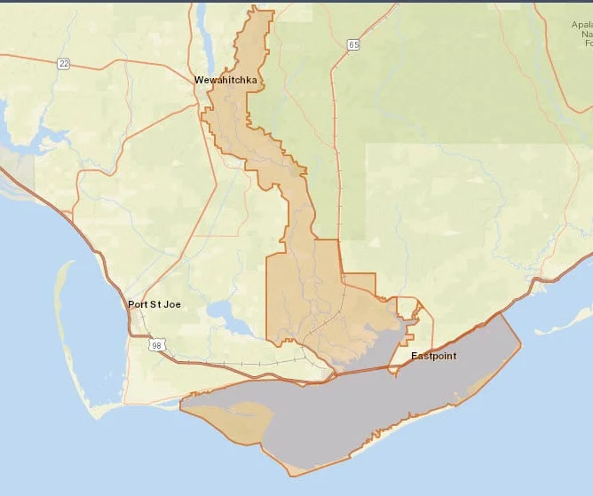
The Apalachicola National Estuarine Research Reserve encompasses 246,766 acres of public lands and waters in the Florida Panhandle. The Reserve boundaries include 52 miles of the lower river and its associated floodplain, most of Apalachicola Bay, two barrier islands, part of a third, and several small out-parcels. The same area was designated a Biosphere Region in 1983 by the UNESCO Man and Biosphere Programme. You can read about the Apalachicola Biosphere Region here.
To manage the diverse natural communities of the Reserve, there is a similarly diverse group of natural resource managers who seek to preserve the important biological function of each component. Partnerships are a necessity and the Reserve has teamed up with local, state and federal agencies in many ways. Primary managers of larger tracts within the Reserve include the Northwest Florida Water Management District, the Florida Fish and Wildlife Conservation Commission, the U.S. Forest Service, the U.S. Fish and Wildlife Service, the Florida Division of Forestry, and the Florida Department of Environmental Protection.


Programs at the Reserve focus on scientific research, natural resource management and environmental education and stewardship for many audiences.
As always, be sure to "tread lightly" on the lands and waters we have been blessed with so future generations can share the same thrills as they come along.
The Reserve Education & Research Center
The Reserve's home is located at 108 Island Drive (State Road 300) at Cat Point in Eastpoint, Florida. This is where the Reserve conducts research, education, administration, and coastal training programs. The Nature Center welcomes the general public to visit Tuesdays - Saturdays, 9:00 a.m. - 4:00 p.m. and enjoy a variety of educational, interactive and live exhibits.
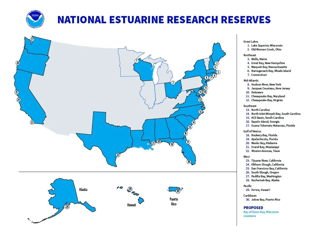
The Apalachicola National Estuarine Research Reserve is part of the National Estuarine Research Reserve System (NERRS), established by Section 315 of the Coastal Zone Management Act, as amended.
Additional information about the system can be obtained from the Estuarine Reserves Division, Office of Ocean and Coastal Resource Management, National Oceanic and Atmospheric Administration, US Department of Commerce, 1305 East West Highway - N/ORM5, Silver Spring, MD 20910.
Florida's three reserves are managed on a day to day basis by the Florida Dept. of Environmental Protection's Florida Coastal Office.
Locally, Franklin County was a key partner in the establishment of this Reserve
in 1979.

National Estuarine Research Reserves System map.

